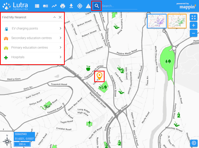
Find My Nearest Tool
The Find My Nearest Tool allows users to quickly locate their nearest features from various map layers.
In the example below, the tool has been configured to allow users to locate their nearest:
- EV charging points
- Primary and secondary schools
- Hospitals
The search centre initially defaults to the map centre and is shown as an orange marker. The search centre can be moved at any time by dragging its marker or left-clicking on the map when the Find My Nearest tool is active.
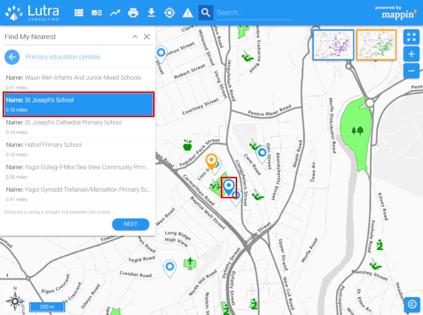
When the user selects a layer (e.g. Primary education centres), Mappin shows the closest features on that layer to the search centre, both on the map and as a table (with their straight-line distance). The attributes displayed in search results can be configured in the same way used by the Search tool. Hovering over a search result highlights its location on the map and clicking a result will zoom to that feature and show its attributes using the Feature Info tool.
Configuration
The Find My Nearest tool has the following settings.
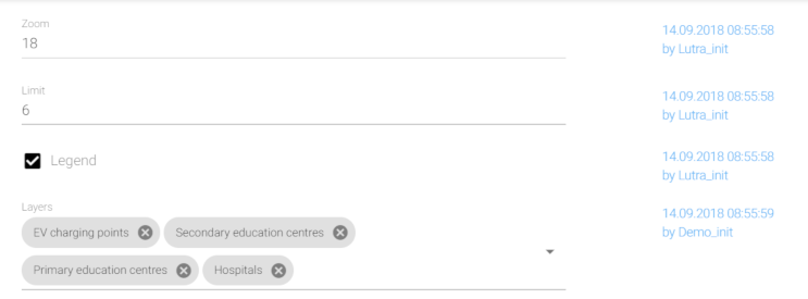
Zoom
When results are presented, Mappin will zoom to fit each page of search results. When the user clicks on a search result, Mappin will zoom-in on that result / feature. This setting specifies the zoom-level it will zoom to.
Limit
The number of results to display per page of results.
Legend
When enabled, displays layers’ legend icons in the Find My Nearest panel.
Layers
Specifies which layers should be searched by the Find My Nearest tool.