Feature Info Tool
The Feature Info tool allows users to examine a feature’s attribute data.
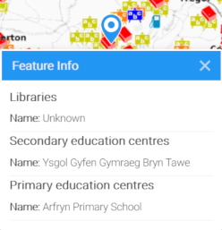
In the above image, the Feature Info tool has picked up three map features from different layers within tolerance pixels (see below) of the user’s mouse click and displays attribute data for those results.
Identified features are grouped by layer.
Configuration
The Feature Info tool has the following settings.
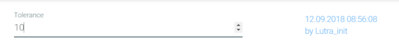
Tolerance
When the user clicks on the map, Mappin will return results for features found within tolerance pixels of the mouse click.
Related Configuration
There are various related configuration options which affect:
- Whether a layer is queryable
- Which attributes are shown by the Feature Info tool
- How those attributes are styled and aliased
Queryability and Layer Alias
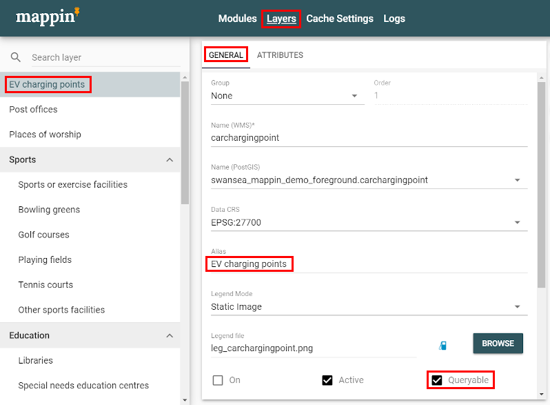
A layer’s settings can be used to specify whether or not it should be queryable by the Feature Info tool. To change this setting:
- Open the project’s administrator interface
- Select Layers from the top menu
- Select the layer of interest
- Select the GENERAL tab
- Toggle Queryable as required (see image below)
The layer name can also be aliased using the Alias setting (in the example above the EV charging layer is actually called chargingpoint but appears to users as the more user-friendly name EV charging points.
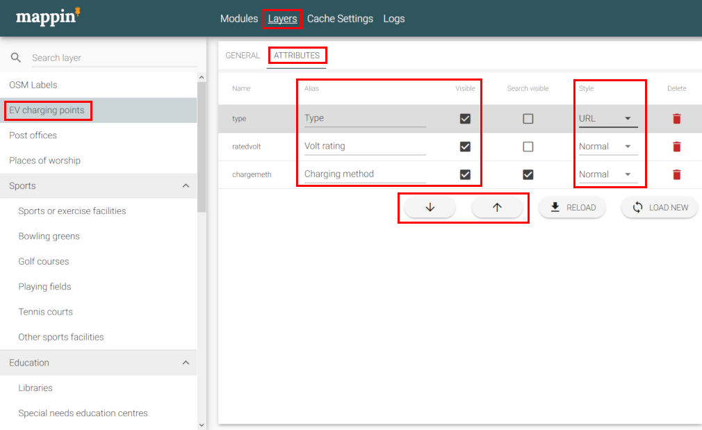
Attribute Settings
A layer’s attribute settings also affect how attribute information is displayed by the Feature Info tool.
It’s possible to:
- Alias attributes with more user-friendly names
- Toggle whether or not an attribute is returned by the Feature Info tool
- Display attribute values in bold or italic
- Display attribute values as hyperlinks, allowing users to open URLs in new browser tabs
- Change the order in which attributes are displayed
To change these settings:
- Open the project’s administrator interface
- Select Layers from the top menu
- Select the layer of interest
- Select the ATTRIBUTES tab
- Change the highlighted settings as required (see image below)