Export Tool
The Export tool allows users to download map layers in CSV or Shapefile format. The Export tool also supports filtering exported data based on spatial or attribute filters.
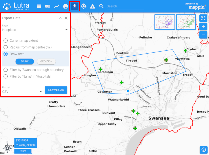
In the image above, the user has opted to export data from the Hospitals layer from within a freehand polygon they’ve drawn on the map. The data will be exported as a CSV file.
Column headings in exported CSV files respect any attribute aliases (if configured) whereas columns in Shapefiles will have the same name as in the source underlying dataset.
The Export tool also allows users to filter exported data based on:
- A radius from the map centre
- A custom drawn area (drawn on-screen or uploaded GeoJSON)
- Intersection with features from another Mappin layer
- An attribute of the exported layer
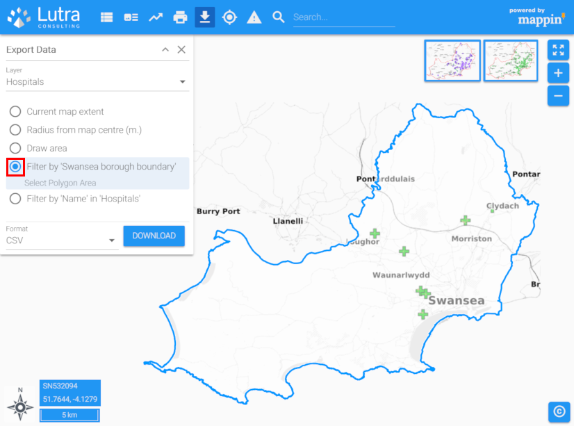
The option allowing the export to be filtered based on intersection with features from another layer can be used to export a subset of a wider dataset by administrative region. For example, if the user wanted to export all hospitals from a national hospitals dataset, but only wanted those within the Swansea borough, they could use this option and select the Swansea borough from a layer of administrative boundaries during export.
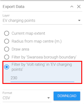
The option for filtering based on attribute could be used to export Electric Vehicle charging points with a rated voltage of 230v.
Configuration
The Export tool has the following settings.
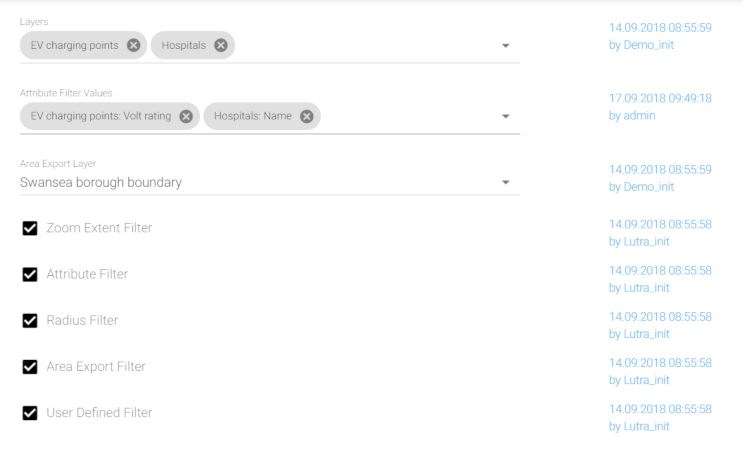
Layers
The layers users may export using the Export tool.
Attribute Filter Values
When using the Attribute filter (see below), the attributes on which to allow filtering.
Area Export Layer
When using the Area Export filter (see below), a polygon layer. The user will be able to select a polygon from this layer to filter their exported data by.
Filter options
These options enable / disable the various filter options.
Related Configuration
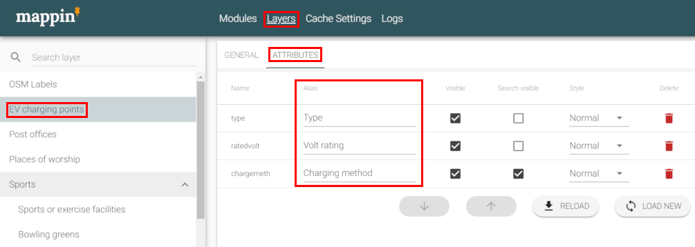
Columns in exported CSV files will be named after the layer’s attribute aliases (if defined). Attribute aliases can be configured as follows:
- Open the project’s administrator interface
- Select Layers from the top menu
- Select the layer of interest
- Select the ATTRIBUTES tab
- Set Alias settings as required